Survey · Inspection · Monitoring
Aerial data for
survey and inspection.
Aerial imagery and spatial data for surveyors, property professionals and project teams.
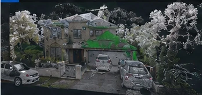
Northbridge, NSW · Point cloud
Services
Survey, inspection
and monitoring.
Survey & mapping
Aerial point clouds, orthomosaics and terrain data for survey and 3D modelling.
Inspection
Images of rooflines and elevated building elements for review.
Monitoring
Repeat aerial capture to document changes across your site.
Data processing
Photogrammetry processing and file preparation for your survey or modelling team.
Outputs
Data and file formats.
Point clouds for survey and 3D modelling.
Source photographs and inspection images.
Georeferenced orthomosaic imagery.
Digital elevation models and contour data.
The survey platform
DJI Matrice 4
Enterprise.
We use the DJI Matrice 4 Enterprise for mapping, inspection and monitoring.
- Platform
- DJI Matrice 4 Enterprise (M4E)
- Positioning workflow
- RTK-enabled capture
- Processing
- Photogrammetry / DJI Terra
- Project handover
- Agreed formats and source imagery
- Example project
- Northbridge case study ↗
How we work
From planning to delivery.
Define
Identify the site features, reference requirements and intended use.
Plan
Review access, operating conditions and the capture approach.
Capture
Acquire the agreed imagery and process the spatial information.
Deliver
Supply the dataset and respond to format requirements.
Client testimonial / Northbridge project
A handover that
fits the workflow.
“What was important to us was that GI Drones was willing to work within our technical requirements rather than simply provide a generic drone output. They were responsive to our requests, provided the required data formats and were receptive to professional feedback.”
Before we fly
Common questions.
Can you fit our existing software workflow?
We agree the file formats and reference system with your team before capture. LAS, E57 and imagery were supplied on the Northbridge project.
What should we send with an enquiry?
Send the site location, features to capture, intended use, preferred formats and timing.
Discuss your project.
Send us the site location, required outputs and timing.