Case study / Survey & mapping
Extending the
surveyor’s view.
Specialist aerial data support for a residential detail survey in Northbridge, NSW.
01 / The brief
A fuller picture of
existing conditions.
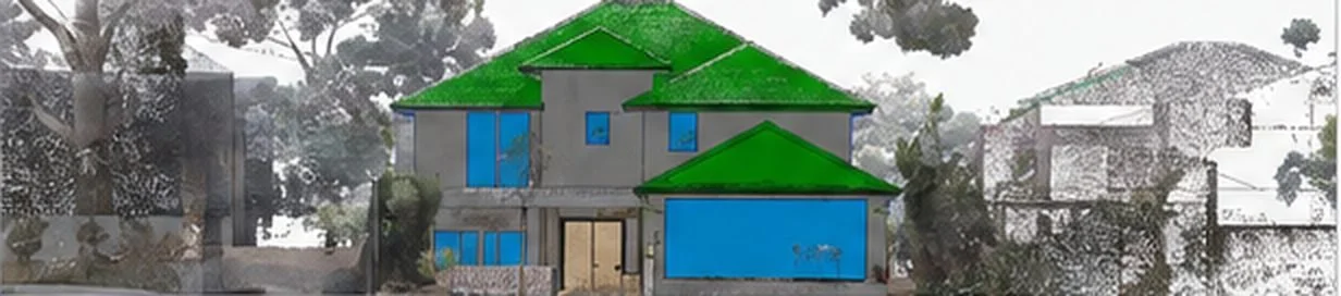
IAM Surveyors was preparing a detailed site survey and front facade elevation for a residential property. The brief called for coverage of rooflines, two swimming pools, elevated features, neighbouring building elements and the wider site context.
02 / Our approach
Capture planned around
the surveyor’s needs.
We captured overlapping aerial images with the DJI Matrice 4 Enterprise and processed them into a point cloud covering the requested site features.
The aerial work formed part of the wider survey process, alongside conventional surveying, terrestrial laser scanning and downstream modelling.
03 / Deliverables
From aerial capture
to usable data.
- Point cloud / LAS — Three-dimensional data adding coverage of buildings, rooflines and surrounding site features.
- E57 — An additional format supplied after the client’s initial review to fit its downstream workflow.
- Original imagery — Source photographs for review, reference and further use by the survey team.
Project record
- Application
- Residential detail survey support
- Method
- Aerial photogrammetry
- Aircraft
- DJI Matrice 4 Enterprise
- Handover
- LAS · E57 · Original imagery
04 / The outcome
How the data was used.
The completed dataset gave IAM Surveyors another source of spatial information to use alongside its existing survey and laser-scanning data. Point-cloud information also supported the modelling workflow behind the required building elevation documentation.
05 / Northbridge project
Client testimonial.
“GI Drones provided us with complementary aerial spatial information that fitted into our existing survey workflow. The aerial dataset gave us additional coverage of rooflines, elevated features and broader site context that can be difficult to observe comprehensively from ground level alone.”
“Based on our experience on the Northbridge project, we would be comfortable engaging GI Drones again where aerial photogrammetry can complement our survey workflow.”
Discuss your next survey project.
Send us the site location and the data your team needs.